Monday 28 November 2016

Hoxton area cycle route improvements

Hackney Council are currently consulting on 'Hoxton Area cycle route improvements' to "improve the area for cycling and walking along the Central London cycle grid". The biggest change is the closure of both Poole Street and Eagle Wharf Road to motor traffic:


However, from looking at the plans above it seems that no actual physical closure is to go in place at this junction, just "cycles only" painted on the entrance to both roads along with no entry signs. If so then this is a poor decision as it is bound to be ignored often by many motorists, just as Pitfield Street is.


Even when physical closures are put in place some drivers will still try to find a way around them

Although credit should go to Hackney Council for acting on this tweet and improving this junction to ensure cars can no longer get round the closures. However it shows that a physical closure of both roads is needed at the junctions in this consultation, perhaps something similar to Brill Place in Camden:


If this kind of closure were to be introduced on both roads then a tiger crossing could possibly be built across New North Road, allowing pedestrians and cyclists to cross the junction

A Tiger crossing on Richmond Road in Hackney, courtesy of the London cycling campaign 
There wouldn't need to be four separate pedestrian crossings at this junction then, just the one.

New North Road itself is three lanes wide here and according to DFT traffic counts is used by around 20,000 motor vehicles per day, including over a thousand buses or lorries, therefore this road should be upgraded with segregated cycle tracks


Yet despite there being space available for cycle tracks here all that is planned for that middle section of the road to become a hatched area, leading to a right turn filter for cyclists:


This is absurd, surely cycle tracks along with a two stage right turn would be a better solution. When I lived in De Beauvoir Town I used to use New North Road ,most days and disliked having to use the right turn filter into Baring Street, the next junction along from here. It is unpleasant to have to "take the lane" in order to manoeuvre into a right turning filter lane on such a busy road and only a small section of Hackney residents are willing to do it.

On Eagle Wharf Road itself the segregated cycle lane that does exist is to be removed and the road made two way, all part of a long term plan to remove segregated cycle lanes from Hackneys streets. If the plans in this consultation go ahead then that will mean that following removal of segregated cycle tracks from Eastway, Goldsmiths' Row, Pitfield Street and now New North Road there would be virtually none remaining. Saying that, I think it would be an improvement if this section of New North Road was to be closed to through motor traffic and therefore access only for local residents, as only a handful of motor vehicles would need to use it per day so a segregated lane would not be needed. However I fear without physical blockage of the road then motor vehicle levels are unlikely to be that low

East of New North Road and Poole Street is also to be made two way. Again I find this road quite pleasant to cycle eastbound on at the minute due to the contraflow cycle lane (although it should ideally be on the other side of the car parking)


But once again I think this would be fine if the road is truly "access only" with a physical closure of Poole Street at New North Road. As Poole Street becomes Penn Street, around 200m east of New North Road, the regeneration of the Colville Estate is underway and as a result the road is closed eastbound to motor vehicles but open to people cycling:


This actually makes it quite pleasant to cycle on and I hope measures are being taken to see what effect this closure has had on traffic in the area. If there is little effect on surrounding roads then maybe it could permanently become one way for motor traffic in order to enable protected cycle tracks for people cycling on this "cycle grid"

A road which is one way for motorists to enable a bi-directional cycle track in Eindhoven

Perhaps this could then be extended onto Hoxton Street and beyond; the one way system for cars could even flip direction at junctions, acting as a "filter" for through motor traffic. This would also severely reduce the amount of motor traffic crossing CS1 at Britannia junction, reducing the many cycling casualties which occur here. A truly ambitious project that would enable anyone, of any age or ability, the chance to travel to school or go shopping locally by bike.

Elsewhere Murray Grove is to be made two way for all traffic with the council stating that "these measures will facilitate the flow of traffic including buses between Shepherdess Walk and New North Road in both directions". Presumably this is to keep the 394 along the same route east and west, rather than splitting the route, as happens now:


As a semi-regular user of the 394 this will make the journey quicker and avoid putting the buses down narrow residential streets so I agree with this proposal, I just wish this was in a separate consultation as this has nothing to do with "improving the area for cycling and walking along the Central London cycle grid".

The consultation is open until Wednesday 30th November. You can respond here.

Tuesday 22 November 2016

Cycling between cities in the Netherlands - Part Ten: Nijmegen to Utrecht

I began my journey out of Nijmegen by riding through Waalfront, an old industrial area alongside the river Waal that is in the process of being regenerated with a mixture of derelict land, new houses being built and former industrial buildings, now all being used by new industries. I'd actually been there the previous evening for dinner and a few beers on the recommendation of my Airbnb host. The Honigcomplex is a huge old food producing factory, the back of which now houses burger joints, coffee roasters and breweries. It reminded me a lot of Queens Yard in Hackney Wick, except I didn't have to cycle with construction lorries to get there; as part of the regeneration of the area new cycling infrastructure has, of course, been built. 


I was here again to visit the Dutch Bicycle Centre, an area of the former factory that now houses over a dozen companies in the cycling industry. I met Jos Sluijsmans who gave me a tour and showed me some great bikes and we talking of cycling in the Netherlands. Jos offered to go with a ride with me around the city but as I knew I had to cycle nearly 50 miles that day to get to Utrecht and would have less than 24 hours in the city by the time I got there I had to regretfully decline. Next time Jos! 

To leave the city I had to cross the River Waal and had a choice of three bridges to do so, and all three had cycle tracks on them of course. The Dutch Bicycle Centre was located almost precisely between two of them and so I chose the newest bridge, which coincidentally turns three years old this week. To get there I had to cycle on quite a large 360 loop in order to access the bridge ascent. It does seem odd that lifts were not added but at least I had a nice cycle track to get me to it. The grass alongside the cycle track was being cut - it is very important that cycle tracks are well maintained like this and that is something the Dutch do well. The cycle track then led me through a busy industrial area before climbing up onto the bridge. From here I could look down onto the redevelopment of Waalfront with the half built cycle track clearly visible. I pondered as to why this couldn't be done in somewhere like the Olympic Park or many other places in London being regenerated with a blank slate. 


Crossing over the bridge itself was quite pleasant with the noise barrier alongside reducing both the noise and wind. It made me think that the proposed elevated cycle superhighway alongside the A40 in West London could work well if designed like this. A shame this scheme has been cancelled then, meaning a lot of work for Sadiq Khan to triple the current superhighway provision, with a focus on segregated lanes, as promised. The bridge was exclusively being used by young students and a dog walker, a couple of whom were happy to smile for the camera and say "cheese" as I took a photo. After a long, fast and fun descent from the bridge I turned off this track and onto a narrow path down to the river. This led me onto a road (which I think was restricted to through motor traffic) and I had a great view of the bridge I had just used before crossing under it on a cycle track. I rejoined the road here, which again I think was restricted to through motor traffic, either way painted cycle lanes soon appeared as did the odd motor vehicle. This continued for around the next five miles, a pleasant enough route with a nice view of the river but nothing particularly interesting to mention. 


I passed under the A50 motorway and then continued on with either water or grass being the main view. The fields around me were mostly flooded following a few weeks of heavy rain, a sign that the well known Dutch flood control measures were working whilst also giving children a chance to play on a boat in the fields.


This road continued for the next 8 or so miles, with nothing interesting to report, until I reached the town of Ochten where I turned away from the river. I was quite glad to do so as nearly 15 miles on the same road had begun to get a little boring. In Ochten I was back to sharing with motor traffic on paved roads again but the only person I saw cycling here was a child on the pavement. I headed out of the town on a cycle track - it was nice to be back on one after so long on that road. The route from Nijmegen to here was fine and I felt safe using it but it was nicer to hear the sound of a motor car behind you and not have to worry about whether you would receive a close pass. Suddenly it started raining heavily and so I took shelter in a cycle parking shelter of a small bus stop before continuing along a cycle track that had clearly been retro fitted into a narrow rural road. I wondered, not for the first time, why this could not happen on many rural A roads in the UK rather than having large grass verges. At several points the road was so narrow between the houses that there was no room for the cycle track and so instead it simply diverted around the back of the buildings alongside the fields instead (the residents of which had their own entrance to the track). The cycle track continued along this road, quite a nice route, until it approached and then ran alongside a railway line and the A15 motorway. I knew these were there from the map on my phone but could not hear them as a large green wall muted the sound. Occasionally there would be a gap in the trees and the sound of motor traffic would seep through along with large advertising boards promoting "Mattie and Wietze in the morning" on Q Music being the only other clue that a major motorway lay on the other side.


I passed under the motorway and railway line before turning north on a cycle track sandwiched between a road and the Amsterdam-Rhine canal. At this point a very British sight appeared - several dozen schoolchildren all decked out in High-Viz, despite being on a cycle track in the middle of the day. I hope this is not a taste of things to come in the Netherlands, but at least they were not wearing helmets. I continued along this road, passing a gigantic DHL warehouse, before the cycle track turned 90 degrees to the left of the road and lead me through some very nice parkland and alongside a lake.


 The track then led me onto a country lane and past a golf club which has a sign outside saying "Welkom Fietsers" with a picture of a cup of coffee underneath it. My Dutch isn't great but even I knew what this sign meant and, as tempted as I was to stop for a coffee, I decided to carry on and get to Utrecht as soon as I could. This road continued for the next few miles, passing under the N835 and the N320 along the way. It was probably the most unpleasant part of the journey as I kept being passed at speed and sometimes quite close by expensive looking cars, almost all of them occupied by a single middle aged man in the drivers seat, quite clearly heading away from a round of golf. What was most frustrating is that I could see from my map, that the wide Amsterdam-Rhine canal was situated just to my left so such a shame a cycle track does not exist running alongside it. Let's hope one day it does!

Reaching the outskirts of Rijswijk I turned left onto the N229 and was glad to be back on a cycle track path again. I was overtaken by three men with far more luggage than me before reaching a jetty for a ferry to take me over the Nederrijn. As the ferry docked five teenage girls exited on bikes, I then boarded the ferry along with two teenage boys for the short ride across the river sat alongside cars. The miserable looking ticket collector came over and after a short conversation with the two teenagers, which presumably was them telling him they had no money, he approached me and I paid my 80 cents. Once we alighted from the ferry I cycled onto a cycle path to the right of the ferry approach


and then on a nice country lane alongside some water and into one of the main shopping streets of the city of Wijk Bij Duurstede. Continuing from here along the main road north on tiled cycle tracks I passed between bus stops and bus stop cycle parking before crossing over to the other side of the road onto a bi-directional cycle track, still coincidentally following the two teenagers from the ferry, nearly two miles after we had alighted. One of them gave a friendly wave goodbye and peeled off as we continued along the cycle track just as the road turned into the very busy N229; fantastic that people of any age can get about by bike here, even right alongside very busy roads


My attention was briefly distracted at this point by a man stood in a hut high in the air ringing bells positioned at the end of long pieces of string in a field alongside the road. My route continued along this busy road for many miles, mostly on a cycle track but occasionally becoming a service road for short periods. It was also clearly a heavily used bus route with buses passing at high speed and every bus stop having large amounts of cycle parking. I passed under the road on the outskirts of Werkhoven, continuing on a service road alongside the other side of the carriageway battling on through the rain until I became so wet and cold that I took shelter under a large cycle shelter at a bus stop on the outskirts of Odijk. A large group of older cyclists passed by, all of them equipped with waterproof overalls once again reminding me what I needed to purchase once I was back home. Continuing along this service road


I reached the A12 motorway where I crossed over the intersection and then travelled along a service road alongside the motorway before crossing under the A12 to use another service road alongside the N411. This route was being used by a lot of people cycling but we had to share the space with several tractors and other farming vehicles who were also it and presumably the prime reason it existed. As I passed a cluster of houses alongside I noticed they all had posters on their windows with a picture of a tractor covered by a big red cross; clearly all the large agricultural vehicles using this service road is an issue here. As we reached the outskirts of Utrecht the service road turned into a cycle track with tractors sent back to the main carriageway, a layout I assume the local residents would  like to see extended. I was now into Utrecht and the cycle track gave way and was replaced by painted cycle lanes, not a particularly pleasant place to cycle and a shame there isn't more dedicated space for cycling, considering the width of the road. As the rain began again I crossed over the old city moat and cycled along the Oudegracht canal in the very centre of the historic city where, it being late on a Friday afternoon, there were plenty of families cycling.

Distance: Approx 70km /  45 miles
Time: Approx  five hours
Photos taken: 570
Map of the route
Gallery:  65 photos here

An an analysis of this trip by Jitensha Oni:


Previous Posts:

Part One - Hook of Holland to Rotterdam / Photo gallery of this journey
Part Two - Rotterdam to Gouda via Delft / Photo gallery of this journey
Part Three - Gouda to Utrecht / Photo gallery of this journey
Part Four - Utrecht to Amsterdam / Photo Gallery of this journey
Part Five - Amsterdam to Hook of Holland via The Hague / Photo gallery of this journey
Part Six - Hook of Holland to Breda / Photo gallery of this journey
Part Seven - Breda to Eindhoven via Tilburg / Photo gallery of this journey
Part Eight: Eindhoven to 's-Hertogenbosch / Photo gallery of this journey
Part Nine: 's-Hertogenbosch to NijmegenPhoto gallery of this journey

Thursday 17 November 2016

Cycling between cities in the Netherlands - Part Nine: 's-Hertogenbosch to Nijmegen

I'd clocked up many miles (or kilometres, if you like) on the bike so far on this trip. Not just riding between cities as detailed on here but cycling within those cities as well, trying to cram in as much cycle track tourism as I could whilst I had the chance. I took a well earned rest for a few hours after arriving in 's-Hertogenbosch before Mark Wagenbuur kindly rode out to meet me after finishing work. For the next two and a half hours we rode all over the city, cycling through new developments after arriving via a cycling viaduct. We talked about many things on the relaxing ride back into the city side by side, the cycling infrastructure of this great city allowing us to do. As we discussed a demonstration that had taken place that very day in London against a bus stop bypass outside a hospital two children of primary school age overtook us, just as we bypassed a bus stop. In the centre of the city we enjoyed cycling on many motor traffic free routes before we had dinner whilst watching young friends and families getting about by bike on a warm summers evening. At one point on our tour Mark had pointed out some markings on a cycle track; this was the about-to-open F59 fast cycle route to Oss. I had already planned my route using the Fietserbond routeplanner and, knowing I would be passing close by Oss suspected that this was the route I would take. A quick look at my phone showed that my route ran alongside the A59 for much of it's length to Oss and so that reassured me that I would be travelling on the new fast cycle route just before it was opening - how great be able to blog about it! However it soon became clear to me after leaving the city that I was not using the F59 and had been directed to a route further south instead. A real shame as I've watched the videos at the end of this post and this would have been an incredible route to take. Therefore if you are ever in 's-Hertogenbosch and are planning to cycle to Oss or Nijmegen then do not use the route detailed below and stick to this route instead! Hopefully the following post will illustrate that whilst the Dutch are building some great fast routes for people to be able to quickly cycle between towns and cities other routes nearby are still mostly pleasurable to cycle on.

Before leaving the city I took a slight detour to take some pictures of a playground and cycle path, built on top of what was a four lane road, that I'd seen the previous evening

I heading east out of the city on a cycle track that was half a kilometre away from the F59, before it turned into a service road for residents but with smooth red asphalt, making clear it was a through route for cyclists. The road became a cycle track again as it passed under the A59 motorway, with its colourful noise barriers, before curving round alongside the road to climb over the Maxima canal on a bridge. There was a sharp descent on the other side, although the cycle track curved round making it not as steep as it could have been. The cycle tracks soon turned into an access road for local residents with painted cycle lanes. 


The houses along here were huge and with some expensive cars in driveways and gardeners working away in front of several of them it was clear this was a wealthy area. Thinking I was on the F59 I began to think of CS11 and the ridiculous protests from wealthy Hampstead residents over such a minor scheme - what would they think of all the filtering of roads that takes place here! The road soon became a cycle track, although I couldn't help notice the barrier blocking vehicles from using it had been removed. It occasionally became an access road for local residents again, but only for a small handful of properties, before it would again turn into a cycle track. The cycle track continued alongside the A59 


before becoming an access road (again with the barrier missing) with painted cycle lanes and then once again becoming a cycle track (with barriers in place but the gaps between them wide enough to get a car through). I was overtaken by a pensioner on an electric assist bike along here before I was once again on an access road (this time finally with barriers and gaps between the barriers that were narrow so no cars could get through). 


I bypassed a couple of roundabouts and at the second roundabout a couple of drivers were parked up and exchanging details after a minor bump. Clearly this was nothing too serious but it reminded me of how glad I was not to be sharing space with them. The cycle track continued on, set back some distance from the road including at junctions, allowing space for motorists to wait as they give way to people cycling. A short while later I came to a roundabout and the mapping on my phone was telling me to continue straight ahead, however the sign at this roundabout was directing me to turn right to cycle to Nijmegen. I had realised by now of course that I was not on the F59 fast route. I began to wonder why the sign would point that way, perhaps, like the F59 there was a better route further south from here? I decided to throw caution to the wind and follow the sign rather than my map, just to see where it took me. I passed under the A59 to travel along a road the other side of the motorway. Initially this route wasn't too bad; I was on painted cycle lanes rather than the cycle track I had been using but they were fairly wide. However they soon narrowed, uncomfortably so and I came to my senses and decided I would return to my original route as soon as I possibly could. Returning north along a bi-directional tiled cycle track I heard voices behind me as I passed under the F59 motorway again and was then overtaken by three young men, all chatting away as they cycled side by side; this cycle track was easily wide enough to accommodate four of us, with room to spare. A reminder of how cycle tracks like this make cycling much more sociable than riding on the road. It is nice to hear people talking to each other whilst they ride at a slow pace, even if I can't understand a word they are saying. 


I was now on the outskirts of Oss and so near to here is where I would have ended up had I taken the F59 fast route, so not a bad alternative overallI turned right across the road and onto a rough track which then turned into an even rougher track, not great to cycle on but I'm sure it would have been much worse had it been raining. At the end of this track I turned left onto a road, an old looking and worn out bi-directional cycle track soon appeared and then shortly later disappeared again, leaving me to rejoin the road. I'm sure this section will be upgraded at some point in the future. I turned off onto a narrow country lane, which was filtered just before I passed over the N329 on a narrow bridge. From the top of the bridge my heart sank as a saw a very rough track ahead of me filled with muddy puddles but thankfully as I got closer I saw a smooth path right alongside. This path continued where the muddy track ended and carried on as a nice smooth path winding through woodland. At a large lake I stopped at some benches to eat a sandwich and followed the first Prime Ministers Question time since the EU referendum vote on my phone, briefly depressing me at the state of politics back home. Groups of cyclists went by as I sat there, mainly elderly couples on electric assist bikes, it being the middle of the day. Just as I made my way off again a large group of elderly ladies arrived, all of them out together on bikes. 


I continued on via a rough gravel path occasionally passing large groups of bicycles parked up, thinking how this would be large areas of car parking back home. The path soon turned into an access road which ended just as the woodland did, so I turned right onto a cycle track alongside a road and then onto a road with painted cycle lanes. 


This road led through several large dairy farms with gigantic sheds full of cows being milked before turning to the right, but I was able to carry straight ahead on a cycle path through fields and crossing over some side roads. I carried on along some residential roads in the suburbs of the city of Ravenstein, before passing under the A50 and then alongside it, on a service road where the signs made clear it could only be used by bicycles and tractors. The motorway and service road soon made their way over a wide River Mass on a bridge, it was very noisy here as lorries passed me by at high speed and I was thinking what a shame it was they did not have noise barriers here. Just then a noise barrier appeared towards the end of the bridge and it felt instantly as though I had inserted ear plugs. I'd become a big fan of these noise barriers on this trip and as someone who lives within hearing distance of the A12 in Hackney it is a real shame TFL hasn't installed any on it. I turned off the service road and made my way along some quiet roads through the village of Niftrik and then a path through fields 


and alongside a railway line, which has since featured in the Cycling Embassy of Great Britain's "Good cycling facility of the week". I was now on a cycle track leading to the centre of the town of Wijchen, a track which bent away from the road by a considerable distance to cross the side roads and providing good visibility for drivers to give way to cyclists. It being early afternoon I saw a few children cycling, either with their parents or on their own. By the main railway station I was surprised to see that both level crossings were filtered and so could only be used by people cycling or walking, not by cars. I made my way to the main high street, which was closed to motor vehicles, and sat down for a coffee and Apple pie, watching people cycling by, some of them very young. It seems the shops all managed to be coping just fine without motor traffic directly outside with deliveries unhindered. I made my way out of Wijchen on this road which was wide with painted cycle lanes once the motor traffic returned. The road then became much wider, with the cycle track set back a considerable distance from the road.


The road itself remained single carriageway though with most of the space taken up by trees and grass. I then reached the N234 and cycled along the service track alongside, which was not a through route for motor traffic and was very wide, wide enough for people to ride four abreast with room to spare.


The service road continued as I passed the sign for Nijmegen, becoming a tiled cycle track which took me over the road and alongside a shopping area. This was a pretty bleak area and reminded me of somewhere like Brent Cross. Howver with a network of cycle tracks and bicycle only roads children could still get around by bike amongst these multi lane roads.


The cycle track continued between the N326 and the shopping centre, taking me onto a bridge over the Maas-Waal canal and then continuing between the road and the railway line into Nijmegen.

Distance: Approx 45km /  30 miles
Time: Approx  four and a half hours
Photos taken:480
Map of the route
Gallery:  78 photos here

An an analysis of this trip by Jitensha Oni:


Previous Posts:

Part One - Hook of Holland to Rotterdam / Photo gallery of this journey
Part Two - Rotterdam to Gouda via Delft / Photo gallery of this journey
Part Three - Gouda to Utrecht / Photo gallery of this journey
Part Four - Utrecht to Amsterdam / Photo Gallery of this journey
Part Five - Amsterdam to Hook of Holland via The Hague / Photo gallery of this journey
Part Six - Hook of Holland to Breda / Photo gallery of this journey
Part Seven - Breda to Eindhoven via Tilburg / Photo gallery of this journey
Part Eight: Eindhoven to 's-Hertogenbosch / Photo gallery of this journey

Wednesday 16 November 2016

Cycling between cities in the Netherlands - Part Eight: Eindhoven to 's-Hertogenbosch

I spent the first two hours of Tuesday morning cycling around Eindhoven and it was impressive at just how pleasurable it was to cycle around such a busy city (with a population of around a quarter of a million people) during the morning rush hour. I described in the previous post how buses were prioritised (along with bicycles) leading from the airport into the city and the situation was similar in the city centre too. Eindhoven has two roads surrounding the (mostly pedestrianised) streets in the very centre of the city, both are one way for motor vehicles (with bus lanes) but with cycle tracks in both directions; positive both for bus passengers who are not delayed behind bicycles as well as for children, enabling them to cycle on these roads. All main roads had cycle tracks of course, along with other cycle only routes, such as the Dommel "silly walks" tunnel. This tunnel is an unusual and interesting place to visit but more importantly it is a well used cycling and walking only route under the railway lines which links the University on one side, with its own network of cycle tracks, with the city centre on the other side, forming a grid of safe cycle routes. Half a kilometre west of this tunnel is another cycling and walking only underpass under the railway lines and the Inner ring Road. Inbetween is a road underpass, with bi-directional cycle tracks along both sides of it, and so the list of why so many choose to cycle here goes on. It was great to see so many people cycling along such busy roads and emphasised what tosh it is when people claim cycle tracks wouldn't work in a busy city in the UK with high bus use. As I stood at one junction that morning taking pictures I saw a mum stop at a set of traffic lights and kiss her child on one of these main roads and felt a bit jealous. I do this to my daughter when I cycle with her in Hackney but do so on the canal or in Victoria Park, why can't we create safe cycling conditions like this on a street in Hackney with buses too? 

I wasn't originally planning on visiting 's-Hertogenbosch and this journey was going to be Eindhoven to Nijmegen but my friend and fellow blogger Mark Wagenbuur invited me to visit the city where he lives, and so I cut my planned visit to Utrecht down to 24 hours and fitted a visit to 's-Hertogenbosch into my trip instead.

Following the morning rush I looked at pictures of Boris Johnson and protests in London under the headline "regrexit?" over breakfast , surprised at just how many pages of this Dutch newspaper were devoted to the Brexit story. I then began my journey north out of the city on a wide road that was closed to motor vehicles due to roadworks. This road was very wide and the main road into the city from the north and so I was amazed that all motor traffic had been removed whilst renovation took place. A bi-directional tiled cycle track was still open along the eastern side of the road but this track was clearly very old with an odd "dual carriageway" arrangement


I did wonder if this track will also be rebuilt at some point as part of these works. Removing that rather pointless central reservation would make for a much wider track, hopefully with some nice smooth red asphalt, although it is already wide enough for people to cycle side by side in either direction as it is. The familiar sight of red asphalt returned as I cycled through a couple of junctions before coming to more roadworks where this time the cycle track was closed along with most of the roadway. The lady in front of me simply cycled up onto the pavement and so I thought I would copy her and continued on the pavement up to the centre of the large junction. Again, this junction was absolutely enormous and clearly where two major roads meet but almost all of it was closed to motor traffic. A new looking bi-directional cycle track had been built on the southern side of the junction and so I hopped round the construction barriers to take some photos of it. 


Just as I was doing this one of the construction workers spotted me and started walking in my direction. The last time this had happened back in London a construction worker had gotten very angry and shouted at me to get out and so, expecting similar treatment, I mentally prepared my "dumb British tourist" routine. He said something to me in Dutch and when I told him I was from the UK he pointed down to the cycle track:
"Do you like it?" he asked.
"Oh.. yes it is lovely, looks very smooth" I replied.
He shook his head and looked down at the track in disappointment "No, it is not good" he replied, "It is not smooth enough and look at the red stuff on there." I noticed an inch or so of red asphalt had made its way onto the pavement at the edge of the cycle track. He knelt down and pointed out the other edge of the track "Those edges, they are really bad. It isn't meant to look like that". He stood up, shook his head one more time and said "it is shit."
I must say it looked great to me and I would absolutely love a cycle track of this quality to be built in London but I wasn't going to argue with a Dutch engineer who builds cycle tracks for a living.
"Have a nice day!" he said, leaving me in the middle of the worksite. I walked over to the northern side of the road and took a picture of the bi-directional cycle track there too, wondering if this was also shit. 

I continued north and the road was initially wide but then narrowed as the area became residential, I passed a park where a mother and her young child were feeding bread to the ducks and geese from the bike. The road ended at a T junction but I was able to continue straight ahead on a bicycle road which led me onto a cycle track through a residential area, I crossed over several quiet residential roads, some of which even had cycle lanes on them but it was clear that driving and cycling routes had been built separately from each other on this housing development. The cycle track continued into fields and led me under the A50 motorway and into an out of town retail development where I kept to cycle tracks past IKEA and various other retailers, safe from the lorries servicing them and industrial businesses in the area. I passed over the Wilhemina canal and cycled alongside the A50 motorway with trees and a drainage ditch between us muting the sound a little. 


The track bent round and ran alongside a road for a short while before I crossed over the roads onto a path through woodland. This was a really fun route, twisting and turning through the trees before it turned into a nice cycle track. 


The trees gave way and the track continued on through farmland. 


This was a lovely route and this cycle track is just a mud track on google maps streetview, dated July 2015 and so can only be a year or so old at most. I turned off onto a country road with painted cycle lanes on it, the lanes soon stopped and the road became a very quiet country lane. It was much like a country lane in the UK except it was not dominated by people cycling in lycra but everyone I saw cycling here were dressed in normal everyday clothes and seemed to be cycling just to get somewhere. 


A family of four out on bikes; the woman has a young child up front on a seat attached to the handlebars

I soon turned off onto a path which led me thorough parkland, where I admired a castle in the distance, into the town of Sint-Oedenrode. It was back to sharing with motor traffic in the town although motor traffic levels seemed very low with most people getting about by bike. I stopped at a cafe for coffee and cake and sat outside watching people going about their business. Motor traffic using the road moved through at a slow pace, due to the design of the road, rather than just painting ugly "20" signs in six foot high markings on a tarmac carriageway and not restricting motor traffic, as would happen in the UK. 

After coffee I cycled through "Markt" the main square in the town, which was pretty but a shame most of it is used as a car park. I turned off into a road that became a dead end for cars but paths continued with small bridges over the river before the path lead me onto a main road. The cycle tracks here varied between tiles and a worn down path, some smooth red asphalt would have been lovely but overall it was fine to cycle along. I turned off this road and continued for the next 7km along country lanes under a very hot sun, again these roads looked very similar to a small country roads in Britain, except these had a 60kph speed limit as opposed to the 100kph that they would have had back home. There were also had raised cobbled areas at every junction, presumably to slow motor traffic down at the places where collisions are more likely to occur. 


Once I reached the N617 I cycled along the service road alongside, which was heavily filtered, before crossing over at a roundabout and using another filtered service road on the other side of the road. Passing along the edge of Sint-Michielsgestel there was an impressive amount of cycle parking, for such a rural location, at a bus stop alongside another roundabout. This roundabout was very odd, it contained a "bear pit" but inside was a roundabout for bikes, within the roundabout for cars. It seemed a bit unnecessary and I almost crashed into it as I filmed it; I've since discovered that a certain local blogger has, of course, written about it before. This bicycle roundabout brought me out onto a residential access road which quickly became a cycle track running alongside the road before turning onto a minor country lane which soon became a service road alongside the N617 as both passed over a wide motorway and led me into 's-Hertogenbosch

Distance: Approx 36km / 22 miles
Time: Approx three hours
Photos taken: 431
Map of the route
Gallery: 60 photos here

An an analysis of this trip by Jitensha Oni:


Previous posts:

Part One - Hook of Holland to Rotterdam / Photo gallery of this journey
Part Two - Rotterdam to Gouda via Delft / Photo gallery of this journey
Part Three - Gouda to Utrecht / Photo gallery of this journey
Part Four - Utrecht to Amsterdam / Photo Gallery of this journey
Part Five - Amsterdam to Hook of Holland via The Hague / Photo gallery of this journey
Part Six - Hook of Holland to Breda / Photo gallery of this journey
Part Seven - Breda to Eindhoven via Tilburg / Photo gallery of this journey

Tuesday 15 November 2016

Cycling between cities in the Netherlands - Part Seven: Breda to Eindhoven via Tilburg

Following a couple of hours of cycling aimlessly around Breda on a Monday morning, just heading in random directions to see what it was like, I began my journey east out of the city on one of the main roads, which had bi-directional cycle tracks along both sides of it. As I approached the river which circles the city I turned left onto a filtered road, which was busy with lots of people cycling and allowed me to avoid the main road on the other side of the water, which just had painted cycle lanes on it. As this route reached a main road the crossing over it was also filtered and this crossing was being used by plenty of young people heading to school / college. 


I travelled east along this main road through a residential area along nice smooth cycle tracks, which continued past side roads, set back from the carriageway. This is very ordinary in the Netherlands but I thought I would stop at a random side road and post it on twitter

Designing streets is this way allows anyone to cycle, even if they have both their dog and child with them. The residential properties suddenly gave way as the road turned into the N282, passing under the A27 motorway with my own set of traffic lights as I reached the slip road leading to and from the motorway. I was now on a bi-directional cycle track (with another on the other side of the road) which passed through an industrial area 


Followed by  countryside as I exited Breda, a very nice city that I hope to revisit one day. Entering the small town of Dorst using a combination of service roads for local residents and tiled cycle tracks it became clear the road alongside was freshly resurfaced, with landscaping work also taking place and I wondered if the cycle track was due to be replaced by red asphalt next. There was no traffic congestion at all and so I was surprised to find the road closed and a diversion in place, even for bikes. I was able to bypass the closure by using minor roads through farmland alongside to quickly return to the closed main road, so eerily silent was it that I briefly filmed itAs I cycled along this main road it was bizarre to not see another human being; no cars or cyclists at all, just me and the sound of birds singing. I even passed a few businesses; a car showroom and some retail places selling caravans and travel equipment, all open but completely devoid of customers. I began to think how this situation probably wouldn't be tolerated in the UK, cars unable to access "outraged" local businesses would make local news. Maybe it does here too. A large fence and defence pillboxes to my right made it clear I was passing a large military base and, as the traffic returned I could see a runway, a lot of military vehicles and even army personnel carrying out training exercises in the large field alongside. I continued along a cycle track that would occasionally become a filtered service road, turning back to a cycle track at the traffic lights where a lorry definitely did not go through a red light as we all know only cyclists do that. I had to cross over a huge crossroads where two main roads, the N282 and N260, met but thankfully I had my own cycle crossing which took me onto a cycle track through a residential area, with a large green wall muffling the sounds of the heavy traffic on the main road on the other side for both myself and the local residents living here


I travelled through the car park between the apartments and the railway line before descending under the railway line through a walking and cycling only underpass. For anyone driving to this housing area they can only get in and out via one entrance onto the main road I'd just left but this underpass meant it was a through route for people walking and cycling. People on bikes get the shorter and more direct route into Tilburg, cars have to go the long way round. After the underpass I cycled along a road that was an access road for cars to local properties but was filtered in several places so could only be used as a through route by bike or on foot. Even when sharing with cars there were still dedicated cycle lanes, along with speed reduction measures for cars. This route was being used by dozens of school children, all of whom were wearing sports equipment, mostly the familiar orange shirts of the Dutch National football team. 


From looking at a map it seems they were all cycling to football pitches nearby from school for football practice. Not all children had a bike and so some were having a backie on the back of their mates bike (you'll hopefully appreciate it did not seem appropriate to take pictures of teenage children in their PE kit at this moment). I thought of the UK and the amount of times I see children on school visits decked out in high viz, even when walking. I don't think a school in the UK would let children cycle independently to their PE lesson, and certainly not sat on the back of someone else's bike, an activity which is very normal in the Netherlands; it is perfectly safe to do this when the roads are designed in this way. I continued on through Reehofspark where they really needed to empty the cycling bin and then onto a nice service road between houses and woods. 


As it was filtered in places it was being heavily used by people cycling but I did not come across one single car using it. I also noticed that it had streetlights all along it so a route that can be used at any time all year round. Despite the lack of motor vehicles a cycle track did then reappear alongside the road, which continued as I carried on into the woods, a very nice route to cycle along indeed.


The cycle track split away from the road at this point, separated from a walkway by a hedge (and still with streetlights!) before emerging next to Tilburg Universiteit railway station above the main road below, giving me an opportunity to photograph the cycle track and bus stop bypass from above. 


The cycle track continued through the railway station car park and alongside access roads, even though they were filtered. I soon turned right under the railway bridge and then onto the main road alongside the main railway stationI could have completely bypassed Tilburg altogether but as it was roughly half way between Breda and Eindhoven I thought I may as well cycle through it to check it out and see if I could find a spot for lunch. I cycled into the centre of the city and came across the entrance to an underground bicycle parking garage. Unsure what the deal was I wheeled my bicycle down before asking the attendant if I had to pay. "Yes, it'll be ten euros, sir" she said before laughing and assuring me that no, I could park for free. The parking lot was half empty but as it is in the main shopping area I assume it is much busier on a Saturday afternoon than lunchtime on a Monday! 


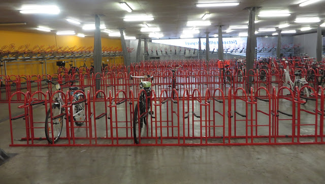
Roughly a quarter of the underground cycle parking facility under the main shopping area of Tilburg

Following lunch I headed out of the city on a cycle track which reminded me of CS2 with its high kerbs, although I wish CS2 had the separation from roadway and side road treatment this one had. I then wished for high kerbs again as I briefly had to use painted cycle lanes before the kerbs returned, along with heavy rain and so I took shelter in a bike parking shelter at the side of the road. I noticed most people simply carried on cycling and was intrigued to see that elderly people cycling appeared to have come prepared and began to unpack their waterproofs whereas younger people just cycled through the rain and got wet. As the rain eased I continued out of the city and alongside the Wilhelmina canal on a tiled cycle track with a road for service vehicles alongside, although it was only being used by joggers. The tiles soon thankfully became asphalt and a much more pleasant ride as I enjoyed watching the geese swim alongside in perfect formation and a local rowing club practising whilst their coach cycled alongside shouting encouragement from his bike through a megaphone.


I crossed over the canal and cycled along the other side, the route was nice, good enough for roadies to use, but it was continually raining along this section of the journey. Not particularly heavy rain but enough to get me wet and I made a promise that as soon as I returned to the UK I would take a leaf from the elderly dutch population and invest in some rain wear. The cycle track suddenly became very smooth as I came across workmen installing new posts alongside the track. It was clear that this section had been freshly resurfaced and further on a tractor was dumping loads of soil alongside the track, presumably for landscaping works alongside. This was a lovely section to cycle along I just wish it had been a sunny day to do so!


The route along the canal came to an end as I reached the town of Oirschot and it was time to turn South towards Eindhoven alongside a road called Eindhovensedijk for a couple of miles


a pleasant enough but unremarkable journey (for the Dutch) before I was back onto another beautifully smooth cycle track alongside the Beatrix canal. I could have stayed on the canal all along as these two canals do meet and it really is remarkable to see how the Dutch not only spend money on ensuring their "leisure" routes alongside canals are well maintained to a very high standard but also provide safe route alongside busy roads nearby so people don't have to go out of the way to find a decent route to ride on. You really can ride almost anywhere from A to B no matter what your age in safe and comfortable conditions.

I very much enjoyed cycling along this lovely track hearing the planes overhead as they landed and took off from Eindhoven airport alongside. I was tempted to carry on but eventually turned off and cycled over the canal and through a residential area as there was a certain local landmark in the suburbs I wanted to see. To get from the area  to the Hovenring I cycled along what seemed like a main road until I noticed that the main road alongside was for buses only and the minor roads on the other side of the cycle track were access roads for local residents. 


The route on a map - a direct route for buses from Eindhoven Airport into the city and for people cycling but despite the width cars cannot use this route. Local residents driving to properties alongside have to go the long way round. However the streets they live on have low volumes of traffic as through traffic is sent elsewhere. Safe, quiet streets for children to cycle and play on

Following ten minutes of just cycling around one of the most remarkable examples of cycling infrastructure I have ever seen it was a short ride into the centre of Eindhoven, firstly along some nice residential roads before a series of really awful roads where painted cycle lanes didn't help much when the traffic volume seemed so high. A reminder that whilst Hovenring is spectacular not everywhere in the Netherlands is perfect for cycling.

Distance: Approx 60km / 37 miles
Time: Approx 6 hours
Photos taken: 680
Map of the route
Gallery:  66 photos here

An an analysis of this trip by Jitensha Oni:

Previous posts:

Part One - Hook of Holland to Rotterdam / Photo gallery of this journey
Part Two - Rotterdam to Gouda via Delft / Photo gallery of this journey
Part Three - Gouda to Utrecht / Photo gallery of this journey
Part Four - Utrecht to Amsterdam / Photo Gallery of this journey
Part Five - Amsterdam to Hook of Holland via The Hague / Photo gallery of this journey
Part Six - Hook of Holland to Breda / Photo gallery of this journey